Tasmania, an Australian state, is located 200 kilometres (125 mi) south of the eastern side of the continent, being separated from it by Bass Strait. The state of Tasmania includes the island of Tasmania, and other surrounding islands. Tasmania has a population of 484,700 (March 2005, ABS) and an area of 68,332 square kilometres (26,383 sq mi).
The distance from the northernmost point (Woolnorth Pt) to the southernmost one (South East Cape) is 364 kilometres (226 miles), the distance from the westernmost (West Pt) to the easternmost one (Eddystone Pt) is 306 kilometres (190 miles).
Tasmania promotes itself as the Natural State and the "Island of Rejuvenation"
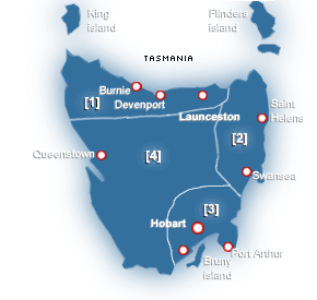
The state capital and largest city is Hobart, which encompasses the local government areas of City of Hobart, City of Glenorchy and City of Clarence. Other major population centres include Launceston in the north, and Devonport and Burnie in the northwest.
The subantarctic Macquarie Island is also under the administration of the state, as part of the Huon Valley Council local government area.
History
It is believed that the island was joined to the mainland until the end of the most recent ice age approximately 10,000 years ago.
Much of the island is composed of Jurassic dolerite, a basaltic intrusion of magma that upwelled through other rock types and formed large columnar crystals as it cooled. Tasmania has the world's largest areas of dolerite, with many distinctive mountains and cliffs formed from this rock type. The Central Plateau and the southeast portions of the island are mostly dolerite. Mt. Wellington above Hobart is a good example, with the Organ Pipes showing the distinct columns. In the southwest, Precambrian quartzites are formed from very ancient sea sediments and form strikingly sharp ridges and ranges, such as Federation Peak or Frenchman's Cap. In the northeast, granites can be seen at Freycinet. In the northwest and west, mineral rich volcanic rock can be seen at Mt. Read near Rosebery, or at Mt. Lyell near Queenstown. Also present in the south and northwest are limestones in which some magnificent caves can be found.
The quartzite and dolerite in the higher mountains show evidence of glaciation and much of Australia's glaciated landscape is found on the Central Plateau and the Southwest. The combination of these different rock types offers incredible scenery, much of it distinct from any other regions of the world.
Physical prehistory
Main article: Tasmanian Aborigines Indigenous people
The first reported sighting of Tasmania by a European was on November 24, 1642 by the Dutch explorer Abel Tasman who named the island Anthoonij van Diemenslandt, after his sponsor, the Governor of the Dutch East Indies. The name was later shortened to Van Diemens Land by the British. Captain James Cook also sighted the island in 1777, and numerous other European seafarers made landfalls, adding a colourful array to the names of topographical features.
The first settlement was by the British at Risdon Cove on the eastern bank of the Derwent estuary in 1803, by a small party sent from Sydney, under Lt. John Bowen for the purpose of preventing the French from claiming the island. An alternative settlement was established by Captain David Collins 5 km to the south in 1804 in Sullivan's Cove on the western side of the Derwent, where fresh water was more plentiful. The latter settlement became known as Hobart Town or Hobarton, later shortened to Hobart, after the British Colonial Secretary of the time, Lord Hobart. The settlement at Risdon was later abandoned.
The early settlers were mostly convicts and their military guards, with the task of developing agriculture and other industries. Numerous other convict-based settlements were made in Van Diemens Land, including secondary prisons, such as the particularly harsh penal colonies at Port Arthur in the southeast and Macquarie Harbour on the West Coast.
Van Diemen's Land was proclaimed a separate colony from New South Wales, with its own judicial establishment and Legislative Council, on December 3, 1825.
European arrival
Although the state is seldom in the world news, global attention has turned to Tasmania a few times. Tasmania was badly affected by the 1967 Tasmanian fires in which there was major loss of life and property. In the 1970s the state government announced plans to flood environmentally significant Lake Pedder. The collapse of the Tasman Bridge when struck by the bulk ore carrier MV Lake Illawarra in 1975 made crossing the River Derwent at Hobart almost impossible. National and international attention surrounded the No Dams campaign for the Franklin River in the early 1980s. This contributed to the start of the Green movement.
Tasmania has received a position in the top ten of several popular international tourism publications.
On April 28, 1996 in the incident now known as the Port Arthur Massacre, lone gunman Martin Bryant shot dead 35 people (including tourists and residents) and injured 37 others. The use of firearms was immediately reviewed, and new gun ownership laws were adopted nationwide, with Tasmania's law one of the strictest in the nation.
The Sydney to Hobart Yacht Race is an annual blue-water sailing event that attracts foreign media attention.
On May 14, 2004 the royal wedding of former Hobart woman Mary Donaldson to Frederik, Crown Prince of Denmark, and their subsequent visit in 2005, again drew some international attention to the state.
In April 2006 the Beaconsfield Gold Mine created world media attention when a minor earthquake triggered a mine collapse that killed one person and trapped two others underground for fourteen days.
World attention
Main article: Geography of Tasmania Geography
See also: commons:Category:Climate diagrams of Tasmania
Tasmania is located at latitude 42° South, longitude 147° East, right in the pathway of the notorious "Roaring Forties" wind that encircles the globe. The Tasmanian climate is extremely variable with high fluctuations in temperature and wind speed during the average week.
Summer lasts from December to February when the average maximum temperature at sea level is 21 °C (70 °F). Winter is from June to August with an average maximum temperature at sea level of 12 °C (54 °F). Inland, temperatures are much cooler. Liawenee on the Central Plateau is regarded as the coldest place in Australia with temperatures even in February ranging only from a still-cold minimum of 4 °C (39 °F) to a delightful maximum of 17 °C (63 °F). In winter the Central Plateau ranges from around -2 °C (28 °F) to 3 °C (37 °F), with much, though very soft, snow.
Highest maximum temperature: 40.8 °C (105.4 °F), Hobart, 4 January 1976
Lowest minimum temperature: -13.0 °C (8.6 °F), Butlers Gorge and Shannon, 30 June 1983
Rainfall in Tasmania follows a complicated pattern rather analogous to that found on large continents at the same latitude in the northern hemisphere. On the western side rainfall incrases from around 1,600mm (64 inches) at Strahan on the coast up to 2,700mm (110 inches) at cradle Valley in the highlands. There is a strong winter maximum in rainfall: January and February typically averages between 30 and 40 percent the rainfall of July and August, though even in the driest months rain usually falls on every second day and the number of rainy days per year is much greater than on any part of the Australian mainland. Further east in the Lake Country, annual rainfall declines to around 900mm (35 inches), whilst in the Midlands, annual rainfall is as low as 450mm (18 inches) at Ross and generally below 600mm (24 inches). Here the rainfall is more evenly distributed than in the west, and most months receive very similar averages.
The densely populated northern coast is a much drier version of the western side, with annual rainfall ranging from 710mm (28 inches) at Launceston to 1,050mm (42 inches) at Burnie in the west and Scottsdale in the east. Most rain falls in winter and in summer the average can be as low as 35mm (1.5 inches) per month in the Lower Tamar. The east coast is wetter than the Midlands, with an average annual rainfall ranging from 1,000mm (40 inches) at St. Helens to around 640mm at Swansea. Herre the rainfall is evenly distributed over the year but can be very erratic as heavy rainfalls from the warm Tasman Sea are quite frequent. Whereas a three-day fall of 125mm (5 inches) occurs only once every fifty years the north coast, it occurs on average once every four or five years around Swansea and Bicheno, and on 7-8 June 1954 there were many falls as large as 230mm (9 inches) in two days in that area. The east coast is sometime called the "sun coast" because of its sunny climate due to the rain shadow of the prevailing westerly winds.
Tasmania's reputation in Australia for having high rainfall, however, differs from the true situation: several sections of inland Tasmania, together with Flinders Island, were declared drought-affected areas by the state government on 1 May 2007.
Soils
All these factors contribute to the extremely diverse Tasmanian vegetation, from the heavily grazed grassland of the dry Midlands to the tall evergreen eucalypt forest, alpine heathlands and large areas of cool temperate rainforests and moorlands in the rest fo the State. Many flora species are unique to Tasmania, and some are related to species in South America and New Zealand through ancestors which grew on the super continent of Gondwana, 50 million years ago.
Vegetation
Main article: Government of Tasmania Government
Tasmania has a number of relatively unspoilt, ecologically valuable regions. Proposals for local economic development have therefore been faced with strong requirements for environmental sensitivity, or outright opposition. In particular, proposals for hydroelectric power generation proved controversial in the late 20th century. In the 1970s, opposition to the construction of the Lake Pedder impoundment led to the formation of the world's first green party, the United Tasmania Group. In the early 1980s the state was again plunged into often bitter debate over the proposed Franklin River Dam. The anti-dam sentiment was shared by many Australians outside Tasmania, and proved a factor in the election of the Hawke Labor government in 1983, which halted construction of the dam. Since the 1980s the environmental focus has shifted to old growth logging, which has proved a highly divisive issue. The Tasmania Together process recommended an end to clear felling in high conservation old growth forests by January 2003.
Tasmanian politics is often characterised as being overly concerned with personality and parochialism. These factors may be due to the relative smallness of the Tasmanian electorate, as well as historical claims of Launceston being the "northern capital". From 1803 until the proclamation of Van Diemen's Land in 1823, the island had been split into two dependencies of New South Wales, with Hobart and Launceston the administrative centres.
In the Commonwealth Parliament, Tasmania is well represented in the Senate, where seats are not proportional to population. Between 1975 and 2005, Tasmanian independent senator Brian Harradine often held the balance of power. As a result he was able to gain the passage of legislation that, although often matching his conservative religious views, was also very financially rewarding for the state. Harradine successfully defended his seat in six consecutive senate elections and did not stand for re-election at the 2004 federal election. His term ended in June 2005.
Tasmania's House of Assembly and local government elections use a system of multi-seat proportional representation known as Hare-Clark.
In the 2002 state election, the Labor Party held 14 of the 25 available seats. The Liberal Party saw their percentage of the vote decrease dramatically, claiming only 7 seats. The Greens won four seats, with over 18% of the vote, the highest proportion of any Green party in any parliament in the world.
On 23 February 2004, the Premier Jim Bacon announced his retirement, due to being diagnosed with lung cancer from smoking. In his last months he opened a vigorous anti-smoking campaign which included many restrictions of where individuals could smoke, such as pubs. He died four months later.
Bacon was succeeded by Paul Lennon, who, after leading the state for two years, went on to win the 2006 state election in his own right.
List of Governors of Tasmania
List of Premiers of Tasmania
Local Government Areas of Tasmania Politics
Tasmania's erratic economy was first experienced by colonists in the early 1800s. The reasons have been many and varied over the years. More recently the reasons have been attributed to: lack of federal infrastructure highway, lack of a gold rush, lack of open immigration initiatives, lack of population, decline in the wool and mineral economies, lack of early colonial initiatives, or lack of foreign investment. For the length of the history of Tasmania there has been a continuing exodus of youth to mainland Australia in order to seek employment opportunities.
Traditionally Tasmania's main industries have been: mining, including copper, zinc, tin, and iron; agriculture; forestry; and tourism. Significantly in the 1940s and 1950s there had been a notion of 'Hydro-Industrialisation' embodied in the state by Hydro Tasmania. These all have had varying fortunes over the last century and more, involved in ebbs and flows of population moving in and away dependent upon the specific requirements of the dominant industries of the time.
There had been a decline in manufacturing during the 1990s, leading to a drain of some of the island's trained and experienced working population to mainland Australia. The major urban centres such as Melbourne and Sydney are popular destinations.
The state has a large number of food exporting sectors, including but not limited to seafood (for example, Atlantic salmon, abalone and crayfish). and overseas migration. A shortage of rental accommodation has caused problems for many of Tasmania's low income earners.
Small business is a large part of the community life and it is believed by many that the business environment in Tasmania is not an easy one to survive in. However there have been many success stories, such as International Catamarans, Moorilla Estate and Tassal.
Economy
The fastest and cheapest method of travel across Bass Strait is by air. The main carriers are Qantas and its subsidiary JetStar, and Virgin Blue, which fly direct routes to Melbourne, Sydney, Brisbane, and Adelaide. Major airports include Hobart International Airport and Launceston Airport; the smaller airports, Burnie (Wynyard) and Devonport, are serviced by Regional Express, which generally fly only to Melbourne and the Bass Strait islands.
The domestic sea route is serviced by Bass Strait passenger/vehicle ferries operated by the Tasmanian Government-owned TT-Line (Tasmania). From 1986 the Abel Tasman made six weekly overnight crossings between Devonport and Melbourne. It was replaced by the Spirit of Tasmania in 1993, which performed the same route and schedule. The most recent change was the 2002 replacement of the Spirit by two Superfast ferries - Spirit of Tasmania I and Spirit of Tasmania II — which brought the number of weekly overnight crossings up to fourteen, plus additional daylight crossings in peak times. In January 2004 a third ship, the slightly smaller Spirit of Tasmania III, started the Devonport to Sydney route. This service was axed by the Tasmanian Government in June 2006 quoting low passenger numbers. Two container ships owned by Toll Shipping also make daily crossings between Burnie and Melbourne. The port of Hobart also serves as a host to visiting cruise ships and before the September 11, 2001 attacks was a regular port of call for United States Navy ships returning home from the Indian Ocean and Persian Gulf.
The state is also home to International Catamarans, a manufacturer of very high-speed aluminium vessels (commonly known as SeaCat) that regularly broke records when they were first launched. The state Government tried using them on the Bass Strait run, but eventually the decision was made to discontinue the run due to concerns over viability and the suitability of the vessels for the extreme weather conditions sometimes experienced in Bass Strait.
Tasmania, Hobart in particular, serves as Australia's chief sea link to Antarctica, with the Australian Antarctic Division located in Kingston. Hobart is also the home port of the French ship l'Astrolabe which makes regular supply runs to the French Southern Territories near and in Antarctica.
Hobart also has the second deepest natural port in the world, second to only Rio de Janeiro in Brazil.
Within the state, the primary form of transport is by road. Since the 1980s, many of the state's highways have undergone regular upgrades. These include the Hobart Southern Outlet, Launceston Southern Outlet, Bass Highway reconstruction, and the Huon Highway.
Rail transport in Tasmania consists of narrow gauge lines to all four major population centres and to mining and forestry operations on the west coast and in the northwest. Services are operated by TasRail, a Pacific National subsidiary. Regular passenger train services in the state ceased in 1977; the only trains are for freight, and there are tourist trains in specific areas, for example the West Coast Wilderness Railway. In 2005 there were concerns that the rail service was in so much trouble that it might stop for everything but cement haulage.
Transport
Culture
During colonial times typical English cuisine would have been standard in most areas of Tasmania. The arrival of immigrants and changing cultural patterns has meant Tasmania now has a wide range of restaurants. Scattered across Tasmania are a number of vineyards and Tasmanian beer brands such as Boags and Cascade are known and sold on the mainland. King Island off the north-western coast of Tasmania has a reputation for boutique cheeses and dairy products.
 Cuisine
In order to foster tourism, the state government encourages or supports several different annual events in and around the island. The best known of these would be the Sydney to Hobart Yacht Race, starting on Boxing Day in Sydney and usually arriving at Constitution Dock in Hobart around three to four days later, during the Taste of Tasmania an annual food and wine festival.
Other events include the road rally Targa Tasmania which attracts world-class rally drivers and is staged all over the state, over five days. Rural or regional events include Agfest is a three-day agricultural show held at Carrick (just west of Launceston) in early May, and the Royal Hobart Show and Royal Launceston Show, both held in October of each year. Music events held in Tasmania include the Falls Festival at Marion Bay (a Victoria event now held in both Victoria and Tasmania on New Year's Eve), and the Southern Roots Festival held in Hobart each Easter. A recent addition to the state has been the 10 Days on the Island arts festival; however, it has drawn criticism from environmental groups for its acceptance of sponsorship from forestry company Gunns.
List of Events in Tasmania Events
Tasmania has a number of relatively unspoilt, ecologically valuable regions. Proposals for local economic development have therefore been faced with strong requirements for environmental sensitivity, or outright opposition. In particular, proposals for hydroelectric power generation proved controversial in the late 20th century. In the 1970s, opposition to the construction of the Lake Pedder impoundment led to the formation of the world's first green party, the United Tasmania Group. In the early 1980s the state was again plunged into often bitter debate over the proposed Franklin River Dam. The anti-dam sentiment was shared by many Australians outside Tasmania, and proved a factor in the election of the Hawke Labor government in 1983, which halted construction of the dam. Since the 1980s the environmental focus has shifted to old growth logging, which has proved a highly divisive issue. The Tasmania Together process recommended an end to clear felling in high conservation old growth forests by January 2003.
Tasmanian politics is often characterised as being overly concerned with personality and parochialism. These factors may be due to the relative smallness of the Tasmanian electorate, as well as historical claims of Launceston being the "northern capital". From 1803 until the proclamation of Van Diemen's Land in 1823, the island had been split into two dependencies of New South Wales, with Hobart and Launceston the administrative centres.
In the Commonwealth Parliament, Tasmania is well represented in the Senate, where seats are not proportional to population. Between 1975 and 2005, Tasmanian independent senator Brian Harradine often held the balance of power. As a result he was able to gain the passage of legislation that, although often matching his conservative religious views, was also very financially rewarding for the state. Harradine successfully defended his seat in six consecutive senate elections and did not stand for re-election at the 2004 federal election. His term ended in June 2005.
Tasmania's House of Assembly and local government elections use a system of multi-seat proportional representation known as Hare-Clark.
In the 2002 state election, the Labor Party held 14 of the 25 available seats. The Liberal Party saw their percentage of the vote decrease dramatically, claiming only 7 seats. The Greens won four seats, with over 18% of the vote, the highest proportion of any Green party in any parliament in the world.
On 23 February 2004, the Premier Jim Bacon announced his retirement, due to being diagnosed with lung cancer from smoking. In his last months he opened a vigorous anti-smoking campaign which included many restrictions of where individuals could smoke, such as pubs. He died four months later.
Bacon was succeeded by Paul Lennon, who, after leading the state for two years, went on to win the 2006 state election in his own right.
List of Governors of Tasmania
List of Premiers of Tasmania
Local Government Areas of Tasmania Politics
Tasmania's erratic economy was first experienced by colonists in the early 1800s. The reasons have been many and varied over the years. More recently the reasons have been attributed to: lack of federal infrastructure highway, lack of a gold rush, lack of open immigration initiatives, lack of population, decline in the wool and mineral economies, lack of early colonial initiatives, or lack of foreign investment. For the length of the history of Tasmania there has been a continuing exodus of youth to mainland Australia in order to seek employment opportunities.
Traditionally Tasmania's main industries have been: mining, including copper, zinc, tin, and iron; agriculture; forestry; and tourism. Significantly in the 1940s and 1950s there had been a notion of 'Hydro-Industrialisation' embodied in the state by Hydro Tasmania. These all have had varying fortunes over the last century and more, involved in ebbs and flows of population moving in and away dependent upon the specific requirements of the dominant industries of the time.
There had been a decline in manufacturing during the 1990s, leading to a drain of some of the island's trained and experienced working population to mainland Australia. The major urban centres such as Melbourne and Sydney are popular destinations.
The state has a large number of food exporting sectors, including but not limited to seafood (for example, Atlantic salmon, abalone and crayfish). and overseas migration. A shortage of rental accommodation has caused problems for many of Tasmania's low income earners.
Small business is a large part of the community life and it is believed by many that the business environment in Tasmania is not an easy one to survive in. However there have been many success stories, such as International Catamarans, Moorilla Estate and Tassal.
Economy
The fastest and cheapest method of travel across Bass Strait is by air. The main carriers are Qantas and its subsidiary JetStar, and Virgin Blue, which fly direct routes to Melbourne, Sydney, Brisbane, and Adelaide. Major airports include Hobart International Airport and Launceston Airport; the smaller airports, Burnie (Wynyard) and Devonport, are serviced by Regional Express, which generally fly only to Melbourne and the Bass Strait islands.
The domestic sea route is serviced by Bass Strait passenger/vehicle ferries operated by the Tasmanian Government-owned TT-Line (Tasmania). From 1986 the Abel Tasman made six weekly overnight crossings between Devonport and Melbourne. It was replaced by the Spirit of Tasmania in 1993, which performed the same route and schedule. The most recent change was the 2002 replacement of the Spirit by two Superfast ferries - Spirit of Tasmania I and Spirit of Tasmania II — which brought the number of weekly overnight crossings up to fourteen, plus additional daylight crossings in peak times. In January 2004 a third ship, the slightly smaller Spirit of Tasmania III, started the Devonport to Sydney route. This service was axed by the Tasmanian Government in June 2006 quoting low passenger numbers. Two container ships owned by Toll Shipping also make daily crossings between Burnie and Melbourne. The port of Hobart also serves as a host to visiting cruise ships and before the September 11, 2001 attacks was a regular port of call for United States Navy ships returning home from the Indian Ocean and Persian Gulf.
The state is also home to International Catamarans, a manufacturer of very high-speed aluminium vessels (commonly known as SeaCat) that regularly broke records when they were first launched. The state Government tried using them on the Bass Strait run, but eventually the decision was made to discontinue the run due to concerns over viability and the suitability of the vessels for the extreme weather conditions sometimes experienced in Bass Strait.
Tasmania, Hobart in particular, serves as Australia's chief sea link to Antarctica, with the Australian Antarctic Division located in Kingston. Hobart is also the home port of the French ship l'Astrolabe which makes regular supply runs to the French Southern Territories near and in Antarctica.
Hobart also has the second deepest natural port in the world, second to only Rio de Janeiro in Brazil.
Within the state, the primary form of transport is by road. Since the 1980s, many of the state's highways have undergone regular upgrades. These include the Hobart Southern Outlet, Launceston Southern Outlet, Bass Highway reconstruction, and the Huon Highway.
Rail transport in Tasmania consists of narrow gauge lines to all four major population centres and to mining and forestry operations on the west coast and in the northwest. Services are operated by TasRail, a Pacific National subsidiary. Regular passenger train services in the state ceased in 1977; the only trains are for freight, and there are tourist trains in specific areas, for example the West Coast Wilderness Railway. In 2005 there were concerns that the rail service was in so much trouble that it might stop for everything but cement haulage.
Transport
Culture
During colonial times typical English cuisine would have been standard in most areas of Tasmania. The arrival of immigrants and changing cultural patterns has meant Tasmania now has a wide range of restaurants. Scattered across Tasmania are a number of vineyards and Tasmanian beer brands such as Boags and Cascade are known and sold on the mainland. King Island off the north-western coast of Tasmania has a reputation for boutique cheeses and dairy products.
CuisineIn order to foster tourism, the state government encourages or supports several different annual events in and around the island. The best known of these would be the Sydney to Hobart Yacht Race, starting on Boxing Day in Sydney and usually arriving at Constitution Dock in Hobart around three to four days later, during the Taste of Tasmania an annual food and wine festival.
Other events include the road rally Targa Tasmania which attracts world-class rally drivers and is staged all over the state, over five days. Rural or regional events include Agfest is a three-day agricultural show held at Carrick (just west of Launceston) in early May, and the Royal Hobart Show and Royal Launceston Show, both held in October of each year. Music events held in Tasmania include the Falls Festival at Marion Bay (a Victoria event now held in both Victoria and Tasmania on New Year's Eve), and the Southern Roots Festival held in Hobart each Easter. A recent addition to the state has been the 10 Days on the Island arts festival; however, it has drawn criticism from environmental groups for its acceptance of sponsorship from forestry company Gunns.
List of Events in Tasmania Events
Main article: Tasmanian Literature Literature
There is, in Tasmania, a varied musical scene, ranging from the Tasmanian Symphony Orchestra whose home is the Federation Concert Hall, to a substantial number of small bands, orchestras, string quintets, saxophone ensembles and individual artists who perform at a variety of venues around the state. Tasmania is also home to a vibrant community of composers including Constantine Koukias, Maria Grenfell and Don Kay, who is the patron of the Tasmanian Composers Collective which is the representative body for composers in Tasmania. Tasmania even has it's own gospel choir, with the Southern Gospel Choir. The Southern Gospel Choir performs regularly and is comprised of students that study at the Conservatorium of Music, which is at the Hobart campus of the University of Tasmania, and people with good voices who simply wish to join. Death Metal band Psycroptic hail from Tasmania and are one of the most prominent Australian metal bands. Apart from the Classical musical season and regular gigs across the state by a number of local and interstate groups two of the highlights of the musical year would be the Falls Festival held during the summer holidays and the Carols by Candlelight held in the weeks prior to Christmas.
Music
Main article: Sport in Tasmania Sport
Tasmania has produced a number of significant people. These include: the actor Errol Flynn, Baywatch actor Jaason Simmons, Dancer and Choreographer Graeme Murphy, Composer Peter Sculthorpe, Crown Princess Mary of Denmark (Mary Donaldson), World Champion Woodchopper David Foster, Australian cricket personalities Ricky Ponting and David Boon Motor Racing Australian Touring car/V8 Supercar John Bowe (1995 champion) Marcos Ambrose (2003-4 champion) Marcos now races in the NASCAR Busch Series.
List of Prominent Tasmanians Prominent Tasmanians
Indigenous animals
The island of Tasmania was home to the Thylacine, a marsupial which resembled a wild dog. Known colloquially as the Tasmanian Tiger for the distinctive striping across its back, it became extinct in mainland Australia much earlier because of competition by the dingo, introduced in prehistoric times. Owing to persecution by farmers, government-funded bounty hunters and, in the final years, collectors for overseas museums, it also appears to have been exterminated in Tasmania. The last known animal died in captivity in 1936. Many alleged sightings have been recorded, none of them confirmed.
Thylacine
The Tasmanian Devil is a carnivorous marsupial found exclusively on the island of Tasmania. The size of a small dog but stocky and muscular, the Tasmanian Devil is characterised by its black fur with white patches. It has a loud and disturbing screech-like growl, possesses a vicious temperament and is predominantly a scavenger. The Devil survived European settlement and was considered widespread and common throughout Tasmania until recently.
Like a lot of the wildlife, fast vehicles on the roads are a problem for Tasmanian Devils, which are often killed while feeding on other road-killed animals such as wallabies.
As of 2005 the Tasmanian Devil population has been reduced by up to 80% in parts of Tasmania by the devil facial tumour disease, which is gradually spreading throughout the island. It is believed the majority have starved when the tumours have spread to their mouths and that the tumours are spread by fighting between devils over carcasses they feed on – typically, fighting devils will bite one another's faces. There is no known cure for the disease, and intensive research is underway to determine its cause. There is also a captive breeding program being undertaken by the Tasmanian government to establish a disease-free, genetically-diverse population of Tasmanian Devils outside Tasmania.
Tasmanian Devil
Many birds of the Australian mainland and surrounding oceans are also found in Tasmania. Tasmania has 12 endemic bird species:
The endemic Tasmanian Emu was exterminated in the mid-1800s. The Tasmanian Wedge-tailed Eagle is a threatened endemic subspecies.
4 honeyeaters (family Meliphagidae) - the Yellow Wattlebird (world's largest honeyeater) and the Yellow-throated, Black-headed and Strong-billed Honeyeaters
3 Australo-Papuan warblers (family Acanthizidae) - the Tasmanian Thornbill, the Scrubtit and the Tasmanian Scrubwren
1 pardalote (family Pardalotidae) - the endangered Forty-spotted Pardalote
1 old-world flycatcher (family Muscicapidae) - the Dusky Robin
1 corvid (family Artamidae) - the Black Currawong
1 parrot (family Psittacidae) - the Green Rosella
1 rail (family Rallidae) - the Tasmanian Native-hen, Australia's only flightless land bird other than the giant ratites (Emu and Southern Cassowary). Birds
Tasmania is home to 11 species of frogs. Three of these are only found in Tasmania, the Tasmanian Tree Frog (Litoria burrowsae), the Tasmanian Froglet (Crinia tasmaniensis) and the only recently discovered Moss Froglet (Bryobatrachus nimbus). Of the 11 species that inhabit Tasmania all are native to Australia. Tasmania is home to the largest breeding population of Growling Grass Frogs (Litoria raniformis), a vulnerable species, which has declined over much of its range.
Frogs
See also Geography of Tasmania.
View of Hobart foreshore with Mt Wellington in the background
Dove Lake and Cradle Mountain, Central Tasmanian Highlands
Bay of Fires, East Coast of Tasmania
A small island just off the shore of Bruny Island, South East of Tasmania
Honeymoon Bay, Freycinet National Park, East Coast of Tasmania
Tessellated pavement, a rare rock formation on the Tasman Peninsula.
Islands:
Lakes:
Significant bridges:
Beaches:
Main highways:
Rivers:
Mountains:
Regions:
See also: List of Australian islands, lakes, bridges, highways, rivers, mountains and regions.
Boundary Islet
Bruny Island
Cape Barren Island
Flinders Island
King Island
Maatsuyker Islands
Schouten Island
Maria Island
Macquarie Island
Great Lake
Lake Gordon
Lake Pedder
Lake St Clair
Lake Burbury
Lake Margaret
Bowen Bridge
Batman Bridge
Bridgewater Bridge
Ross Bridge
Richmond Bridge
Sorell Causeway
Tasman Bridge
Bakers Beach
Bellerive Beach
Boat Harbour
Bay of Fires, Binalong Bay Beach
Coles Bay
Howrah Beach
Ocean Beach
Sisters Beach
Wine Glass Bay
Arthur Highway
Bass Highway
Brooker Highway
East Tamar Highway
Esk Highway
Lake Highway
Lyell Highway
Midland Highway
Murchison Highway
Tasman Highway
West Tamar Highway
Zeehan Highway
Arthur River
Derwent River
Franklin River
Gordon River
Henty River
Huon River
King River
Leven River
Meander River
Mersey River
North Esk River
Pieman River
Picton River
Queen River
Savage River
South Esk River
Styx River
Tamar River
Ben Lomond
Cradle Mountain
Federation Peak
Mount Field
Frenchmans Cap
Great Western Tiers
Mount Ossa
Mount Wellington
West Coast Range
Huon Valley
Central Highlands
Derwent Valley
East Coast
Freycinet Peninsula
Midlands
North-West Coast
South West Wilderness
Tamar Valley
Tasman Peninsula
West Coast of Tasmania See also


No comments:
Post a Comment